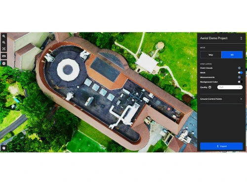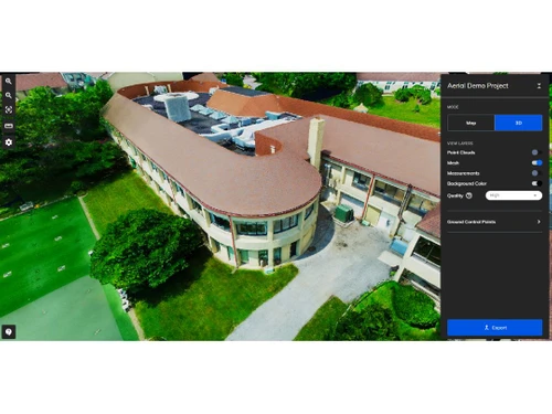
Mapware serves as a comprehensive solution for generating detailed 2D and 3D maps from aerial photographs and ground-based images. This software is particularly beneficial for industries such as construction, surveying, and real estate, where precision in mapping and visualization is essential. Users can perform virtual inspections, export images, and share maps seamlessly, enhancing their workflow efficiency.
Characterized by its intuitive interface and robust functionality, Mapware allows users to measure distances, monitor site developments, and create intricate 3D visuals with little effort. The platform supports a variety of data formats for import and export, ensuring that data handling is straightforward and efficient. With tools designed to boost accuracy and detail in mapping, Mapware enables professionals to achieve high-quality outputs expeditiously. Starting at $293, pricing varies based on features, deployment options, and user counts. For additional information, inquiries can be directed to the product team regarding pricing and available promotions.