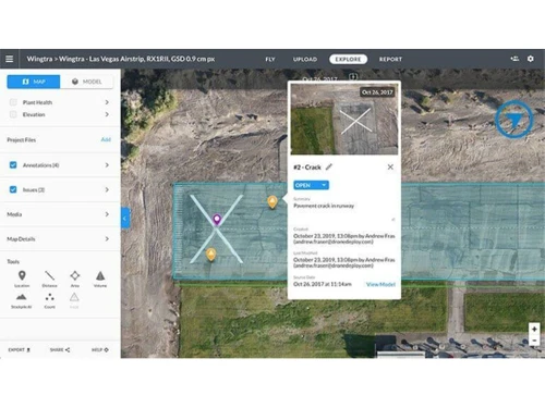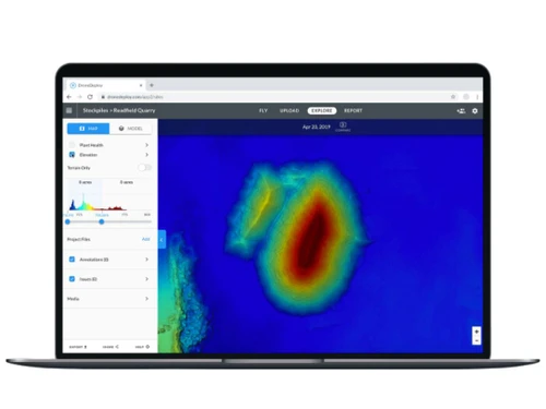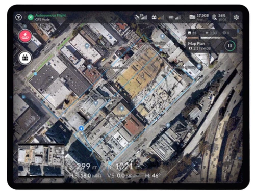
Drone mapping software serves essential functions in industries such as agriculture, construction, and surveying, providing crucial data collection and mapping capabilities. Users can efficiently plan drone flights, capture images, and develop comprehensive 3D models and detailed maps of targeted locations. With DroneDeploy, users can upload images captured by drones, which are then processed using sophisticated algorithms to produce high-resolution outputs.
The generated maps facilitate various analyses, such as monitoring crop health, assessing construction developments, and evaluating terrain conditions. Collaboration features allow teams to work seamlessly across distances, making data-driven decisions more accessible. Pricing for DroneDeploy in India begins at $329 on techjockey.com, with variations based on additional features, deployment options, and user counts. For detailed inquiries about the software’s pricing and available offers, the product team can provide further assistance.