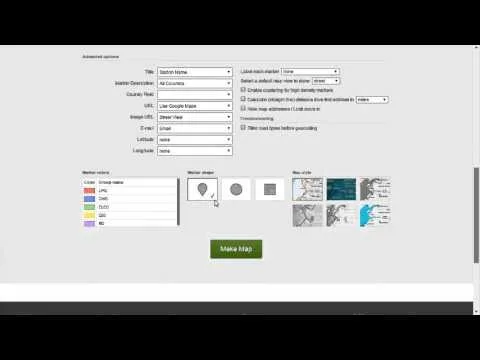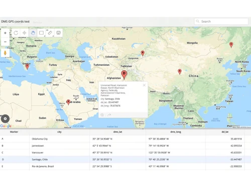
BatchGeo specializes in geographical information system (GIS) software, aiming to make mapping accessible for users in various fields. This tool allows individuals and organizations to visualize data on maps, enhancing decision-making and spatial analysis. Features include batch geocoding, which helps users convert addresses into geographic coordinates, and the ability to share and embed maps seamlessly.
Before making a purchase, potential users can access reviews and gain a better understanding of how BatchGeo meets their mapping needs. A free demonstration of the software is also offered, along with discounts, making it an appealing option for those looking to integrate mapping solutions into their operations.