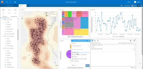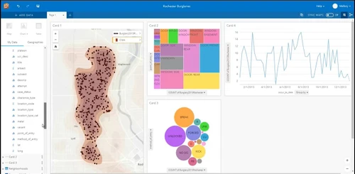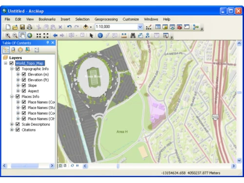
Designed for professionals in geographic information systems, ArcGIS Desktop Basic serves as a fundamental tool for creating, analyzing, and sharing geo-data. Users can develop customized maps that incorporate both existing datasets and newly gathered observations, enhancing the depth and utility of their geographic analyses. This capability is vital for organizations focused on geo-data management, enabling teams to make informed decisions based on comprehensive geographical insights.
ArcGIS Desktop Basic is particularly beneficial for organizations that conduct demographic surveys and analyze geographical data. It facilitates a detailed understanding of specific areas, allowing users to uncover critical details that are often missed in traditional geographic studies. The software is offered in three distinct plans, with pricing dependent on factors such as organizational size and deployment preferences.