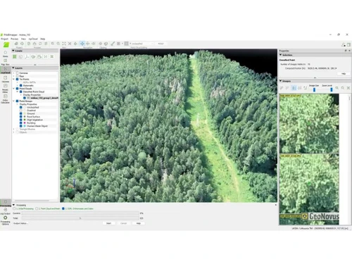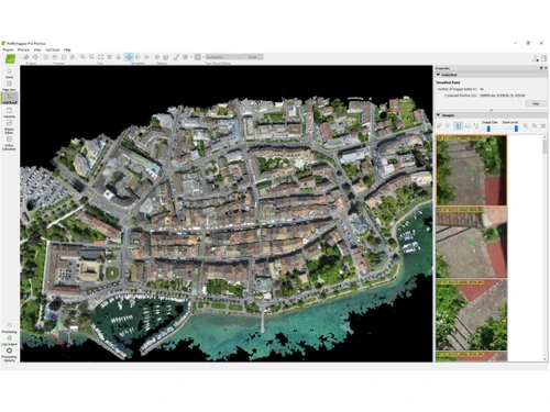
Photogrammetry software enables the transformation of images into precise and intricate 3D models and maps. PIX4Dmapper excels in producing a range of outputs such as 3D point clouds, digital surface models, terrain models, and orthomosaics derived from aerial imagery. With applications in sectors like surveying, mining, public safety, infrastructure, energy, and telecommunications, this software showcases its versatility across various fields.
The platform provides customizable processing options, allowing users to tailor data handling according to specific project requirements. PIX4Dmapper’s strong reputation stems from its reliable ability to generate high-quality digital spatial representations from photographic data. In India, the starting price for PIX4Dmapper is $292, with costs varying based on features, deployment type, and user count. For inquiries regarding pricing and available offers, interested parties should reach out to the product team.