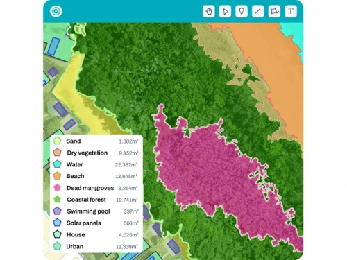
GeoNadir serves as a cloud-centric solution for photogrammetry, tailored specifically for drone mapping applications. It empowers users to upload, process, and analyze aerial data effectively, facilitating the creation of intricate maps and models. The platform is particularly advantageous for professionals engaged in environmental monitoring, conservation, and research, offering high-resolution outputs such as ortho mosaics and digital surface models.
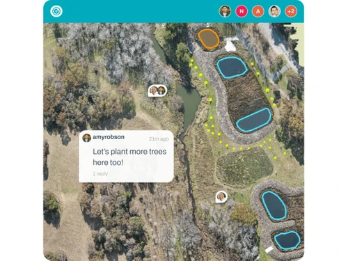
In addition to its robust mapping capabilities, GeoNadir enhances collaborative efforts with features that support real-time interactions and integration with various spatial tools. Pricing details can be obtained through inquiries made via techjockey.com, where users can discuss options based on specific needs like additional functionalities, deployment methods, and user capacity.